Roger J. Wendell
Defending 3.8 Billion Years of Organic EvolutionSM

Highpoints and
Topographic Prominence!
Panorama Point, Nebraska - 1,653 metres (5,424 feet)It wasn't until May of '09, while hiking with Tom and Linda Jagger (in South and North Dakota), that I'd ever thought about highpoints before. However, prior to that fateful date I had already done the highest points in Africa, Colorado, Hawai'i, Oklahoma, Washington State, and a couple other places simply because I was in the neighborhood and it seemed interesting! (Well, admittedly, Kilimanjaro and Rainier were planned in advance, a bit...) Anyway, I didn't really start actively searching around for highpoints until the middle of my fifth decade and found it so much fun that I created this page in attempt to document my progress. The main thing, of course, is that that we all get out there and enjoy the natural world in whatever ways satisfy us most with the least amount of impact. For me, at this time, it's highpoints!
Oh, and for a definition: "Prominence" In topography, "prominence" is the height of a mountain or hill's summit by the vertical distance between it and the lowest contour line encircling it and no higher summit - Prominence is a measure of the independence of a summit. Only summits with a sufficient degree of prominence are regarded as independent mountains. For example, the world's second-highest mountain is K2 (height 8,611 metres, prominence 4,017 metres). While Mount Everest's South Summit (height 8,749 metres, prominence about 10 metres) is taller than K2, it is not considered an independent mountain because it is a subsummit of the main summit (which has a height and prominence of 8,848 metres).NOTE: LIDAR (Light Detection and Ranging) was put into use many decades after I started hiking and climbing. LIDAR is a more accurate way of measuring the Earth's surface and, as such, has changed what was believed to be the elevation of many mountains and highpoints. As a result, the "prominence" (at least 300 feet above a connecting saddle) of many mountains has changed along with their elevations. A personal example, for me, is Republican Mountain - a previously "unranked" 12er near Silver Plume that I climbed in 2022 after learning that LIDAR had determined it now had 312 feet of prominence. Peak 8, near Breckenridge is another personal example of change brought on by LIDAR. When I originally climbed Peak 8 I believed it to be a 12er, only to learn later that it's actual elevation is 13,005 feet! So, in summary, many of the elevations you see on my pages may not (yet) be accurate - requiring an update someday in the future as time permits!

Click Here for my 14ers page...
Click Here for my 13ers page...

Click Here for the Ten Essentials - Don't leave home without 'em!
Click Here for my 12ers page...
Click Here for my notes on hiking...
Click Here for other peaks and mountaintops that I've summited...
Click Here for my general notes Climbing and Mountaineering.
Highpointing Records!
Cari Sayre, me, & Dave Johnston with antique ice pitonsCari Sayre and Dave Johnston, with their son Galen Johnston (not shown), were the first family ever to climb all 50 state highpoints! Not only that, but Dave was the first (and only) person to climb all 50 state highpoints in the dead of winter! Also, Dave and his son climbed Denali when Galen was only 11 years old - the youngest person to ever have climbed America's highest peak. This photo was taken by John Mitchler (Highpointers Club newsletter editor) while visiting with me at the CMC office - we're all proudly displaying antique ice pitons that the club was giving away at that time. On 03/19/2005 Highpointers.org quoted a News Tribune report about Dave Johnston, a 62-year-old climber from Talkeetna, Alaska, as being, "...the first man to climb to the highest point in all 50 states in the winter." They went on to ad that, "In 2003, Johnston, his wife, Cari Sayre, and son Galen all completed 50. That same year, Galen became the youngest person to check off the list at age 12." They ended the article with, "The 6'6" Johnston is probably most famous for his 1967 first winter ascent of McKinley - a climb in which one member of the party died by falling into a crevasse and the party on the descent was forced to spend six days in a small ice cave while a wind storm dropped temps to -148."


Until 2018, my coworker, Maddie Miller (her cubicle was adjacent mine at the time of this photo...), held the record for climbing ALL 50 state highpoints in the shortest amount of time. Starting with Denali, Maddie and her mentor Melissa Arnot completed all of them in 41 days, 16 hours, and 10 minutes! They did this back in 2016 - it's estimated less than 300 people, at that time, had climbed all 50 state highpoints. And, of course, it takes most people a few years! Anyway, Maddie's story is fascinating so I hope to get her on the air for an interview sometime soon!
North Dakota - White Butte
3,506 feet (1,069 metres)
Dorothea, me, Dawn & Linda
White Butte
Tom, Dorothea, Linda & Dawn
Linda & Dawn
Me

Click Here for a YouTube video Tom taking a wind measurement on top White Butte!
South Dakota - Black Elk Peak (formerly Harney Peak at the time I climbed it...)
7,244 feet (2,208 metres)
Note: We did this one the "hard way" over a 14 mile loop...
Tom, Dorothea, Dawn & Linda
Me in the wilderness
Little Devil's Tower
Iron trail
Me, Tom, Linda, Dawn & Dorothea
Click Here for a YouTube video through the cave to the top of Black Elk Peak (formerly Harney Peak)...
Dates I climbed, hiked, and walked to some of the U.S. state highpoints:
Although I have had extensive visits to all 50 states I didn't think to seek out their highpoints
'till I was in my mid 50s! So, back I go to visit more of my country to cure my highpoint fever...
- Alabama - Cheaha Mountain, 09-30-2012
- Alaska
- Arizona - Humphreys Peak, 07-29-2012
- Arkansas - Signal Hill on Mount Magazine, 10-05-2012
- California - Mount Whitney, 07-26-2012
- Colorado - Mount Elbert, 09-22-2002
- Connecticut
- Delaware
- Florida - Britton Hill, 09-29-2012
- Georgia - Brasstown Bald, 09-30-2012
- Hawaii - Mauna Kea, 02-13-2007
- Idaho - Borah Peak, 08-12-2012
- Illinois
- Indiana - Hoosier Hill, 10-18-2015
- Iowa
- Kansas - Mount Sunflower, 03-15-2015
- Kentucky - Black Mountain, 10-17-2015
- Louisiana - Driskill Mountain, 10-05-2012
- Maine
- Maryland
- Massachusetts
- Michigan
- Minnesota
- Mississippi - Woodall Mountain (formerly Yow Hill), 10-04-2012
- Missouri - Taum Sauk Mountain, 10-10-2015
- Montana - Granite Peak, 07-29-2015
- Nebraska - Panorama Point, 12-16-2012
- Nevada - Boundary Peak, 08-03-2011
- New Hampshire
- New Jersey
- New Mexico - Wheeler Peak, 06-10-2011
- New York
- North Carolina - Mount Mitchell, 10-01-2012
- North Dakota - White Butte, 05-24-2009
- Ohio - Campbell Hill, 10-17-2015
- Oklahoma - Black Mesa, 05-14-2006
- Oregon
- Pennsylvania
- Rhode Island
- South Carolina - Sassafras Mountain, 10-01-2012
- South Dakota - Black Elk Peak (fomrerly Harney Peak), 05-23-2009
- Tennessee - Clingmans Dome, 10-02-2012
- Texas - Guadalupe Peak, 12-10-2011
- Utah - Kings Peak, 09-22-2011
- Vermont
- Virginia
- Washington - Mount Rainier, 07-02-2000
- West Virginia
- Wisconsin
- Wyoming
In the Queue: Highpoints I've completed that I still need to list and catalog...
- Alto de Coloane, Macau - December, 2014
- Aspen Peak, Hualapai Mountains, Arizona
- Baker, Mount (Komo Kulshan) 10,778 feet
- Bear Peak, Colorado
- Boulder Peak (south), Colorado
- Doi Inthanon, Thailand - December, 2014
- Garfield Peak, Colorado
- Genesee Mountain, Colorado - 8,284 feet 09-13-2014
- Green Mountain, Colorado
- Tempe Butte, Arizona
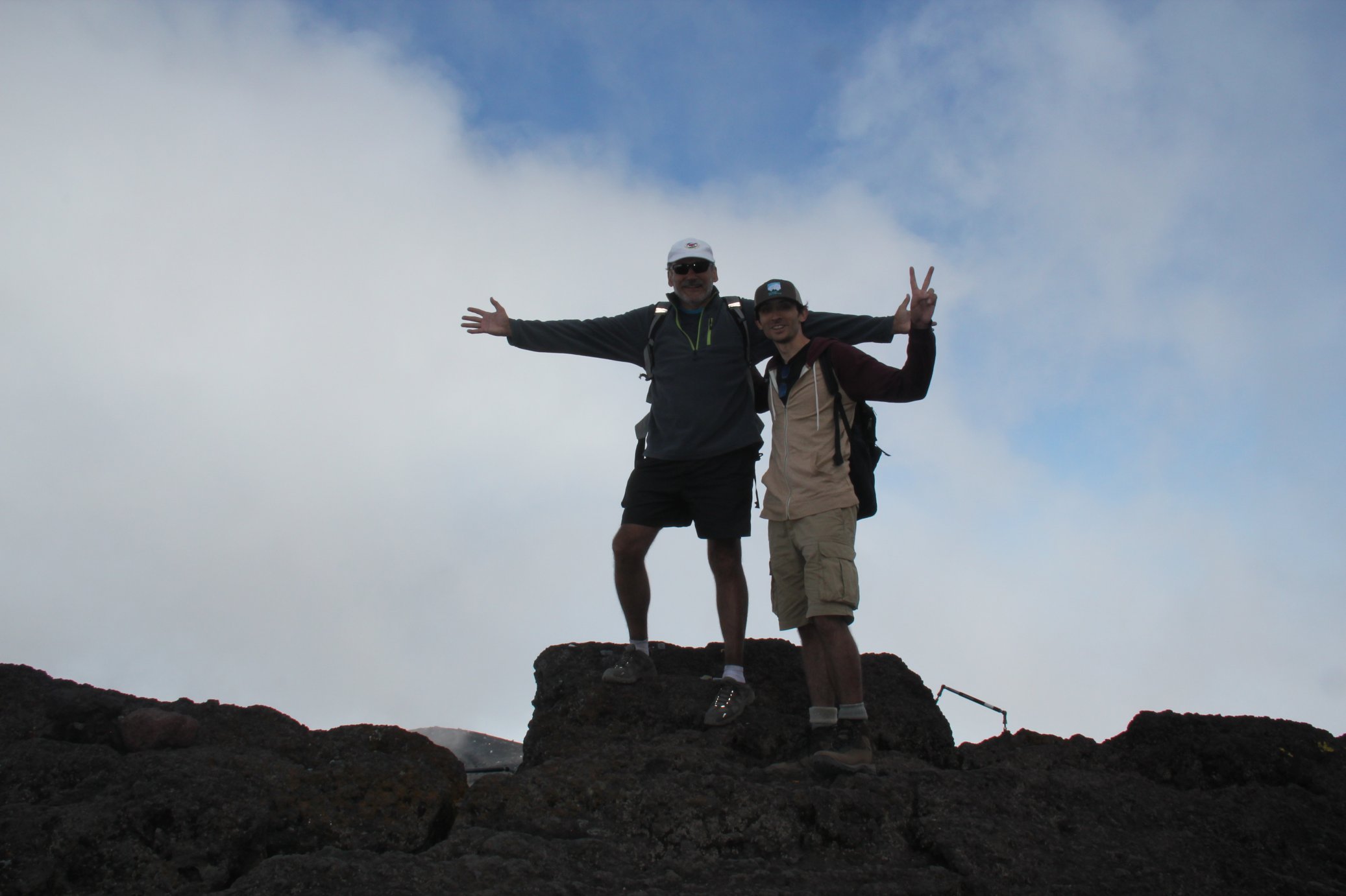
- Fuji, Mount (Ken-ga-mine 12,388 ft) - July 20, 2017 [with Dr. Roger A. Wendell]
- Kastiyu, Tinian Island (187 metres) Tinian Island, CNMI - May 2015
- Kinabalu, Mount (Gunung Kinabalu), Malaysia - December 10, 2014
- Lemmon, Mount, Arizona 2,792 metres (9,159 feet) 06-12-2007 [Highest Point in the Santa Catalina Mountains]
- Lenana, Point (Mt Kenya), Africa
- Morrison, Mount, Colorado
- Storm Peak, Colorado
- Tapochau, Mount - Saipan, CNMI - June, 2015
- Tempe Butte (O'odham: 'Oidba? Do'ag), Arizona via the Hayden Butte Trail for 100.5 metres/330 feet of prominence - March 1, 2014
- Victoria Peak, Hong Kong - December, 2014
- Wilson, Mount, California
- Zenobia Peak - Highest point in Dinousaur National Monument, Colorado - 9,005 feet (August 15, 2010)
Near Misses: Highpoints I got pretty close to but didn't quite make it...
- Agrigan Island, CNMI (made it up to 3,140 feet - summit was only 26 feet higher...)
- Aconcagua (made it to just over 6,431 metres / 21,100 feet...)
Highpoint Waypoints

For personal safety, and just for the fun of it, I usually take a GPS "reading" on the top of each peak, at the trailhead, or some other interesting point or curiosity along the way. WARNING: I cannot guarantee the accuracy of these waypoints as my own GPS bounces around a lot or I simply take an incorrect reading! Please rely on a more accurate source for your Waypoints! That being said, I still enjoy "cataloging" Waypoints and I keep a bunch of other locations, from around the world, on my 13ers, 14ers, Hiking, Waypoints, and other pages...
Bison Peak, Lost Creek Wilderness, Colorado N 39° 14.301' W 105° 29.870' 12,431 feet 3,789 metres Borah Peak, Idaho N 44° 08.244' W 113° 46.866' 12,662 feet 3,859 metres Humphreys Peak, Arizona N 35° 20.785' W 111° 40.677' 12,633 feet 3,859 metres Tempe Butte/Hayden Butte ('Oidbad Do'ag), Arizona N 33° 25.693' W 111° 56.693' 1,395 feet 426 metres Woods Mountain, Colorado Front Range N 39° 43.844' W 105° 50.385' 12,940 feet 3,944 metres

Lost Creek Wilderness, ColoradoSome Trailheads:
Arizona Snowbowl (for Humphreys Peak) N 35° 19.876' W 111° 42.697' 9,278 feet 2,828 metres Borah Peak Trailhead (at the little cattle protected entrance through the wooden fence) N 44° 07.954' W 113° 50.042' 7,400 feet 2,255 metres Ute Creek trailhead, Lost Creek Wilderness, Colorado N 39° 11.885' W 105° 33.212' 8,750 feet 2,667 metres
Yosemite Decimal System
The Yosemite Decimal System (YDS) is a three-part system used for rating the difficulty of hikes and climbs. YDS is primarily used by mountaineers in the United States and Canada. However, there are many different rating systems used around the world. Examples include the British trad grade, the French sport grade, and the International Climbing and Mountaineering Federation's (UIAA) alpine grade. As for the YDS, it was first devised by members of the Sierra Club in Southern California in the 1950s. YDS was a refinement of earlier systems, particularly those developed in Yosemite Valley.Class 1: Hiking on a trail.
Class 2: Simple scrambling, with the possibility of occasional use of the hands. Little potential danger is encountered.
Class 3: Scrambling with increased exposure. Handholds are necessary. A rope could be carried. Falls could easily be fatal.
Class 4: Simple climbing, possibly with exposure. A rope is often used. Falls may well be fatal.
Class 5: Is considered technical roped free climbing; belaying is used for safety. Un-roped falls can result in severe injury or death. Class 5 has a range of sub-classes, ranging from 5.0 to 5.15d, to define progressively more difficult free moves.Classification of climbs can vary quite a bit depending on location and history. Indoor gym ratings tend to be inflated compared to outdoor ratings. Ratings tend to be lower in outdoor areas where climbing routes were developed in earlier years. Guidebooks have often raised the ratings on older climbs to make them more comparable to newer ratings. The YDS grade system also involves an optional Roman numeral grade that indicates the length and seriousness of the route. The grades are:
Grade Duration I One to two hours of climbing II Less than half a day III Half a day climb IV Full day climb V A climb lasting 2–3 days VI A climb lasting 4–6 days VII A climb lasting a week or longer
Tired hikers on Mount Fuji (12,388 ft)Links:
- 12ers
- 13ers
- 14ers
- 14ers.com
- Aconcagua
- Africa (Eastern) - Kenya, Tanzania, and my Kilimanjaro climb
- Africa (Southern) - Our trip through Botswana, South Africa, Zambia, Zimbabwe
- American Highpoints (Trailer)
- AIARE - The American Institute for Avalanche Research and Education
- Alpine Resuce Team - Evergreen, Colorado
- Amazonia and Ecuador
- American Avalanche Association
- Antarctica
- Argentina and Brazil
- Australia Main Page
- Australia Two Page
- Bear Safety
- Bolivia
- Camping
- Champ Camp
- Climbing
- Climbing Photos
- CMC page
- COHP - County Highpointers
- Colorado
- Colorado Avalanche Information Center
- Colorado Fourteener Iniative - A Partnership for Preservation
- CORSAR - Colorado Outdoor Recreation Search and Rescue Card
- U.S. County highpoints
- U.S. State highpoints
- Gear - Stuff for the Backcountry...
- High Altitude Medicine Guide
- Highpointers Club
- Highpointers Foundation
- Hiking
- LOJ - Lists of John (Lists of Peaks)
- Japan
- Leave No Trace - Center for Outdoor Ethics
- LOJ - Lists of John
- New Zealand
- Other Peaks and mountaintops that I have summited
- Peakbagger.com
- Pikes Peak
- Russia
- Silk Road
- Skiing - in the backcountry!
- Snow Caves
- Snow Day
- Summitpost.org
- Survival in the backcountry
- Ten Essentials - Don't leave home without 'em!
- Tibet
- Travel
- Travel Two
- United Kingdom - England
- United Kingdom - Wales and Scotland
- Walking softly in the backcountry
- Waypoints
Warning! Climbing, mountaineering, and backcountry skiing are dangerous and can seriously injure or kill you. By further exploring this website you acknowledge that the information presented here may be out of date or incorrect, and you agree not to hold the author responsible for any damages, injuries, or death arising from any use of this resource. Please thoroughly investigate any mountain before attempting to climb it, and do not substitute this website for experience, training, and recognizing your limitations!
Back to Roger J. Wendell's Home Page...

Abbey | About | Blog | Contacting Me | Copyright | Disclaimer | Donate | Guest Book | Home | Links | Site Index | Solutions | Terms, Conditions and Fair Use | What's Changed or New?
Copyright © 1955 -


 on Mount Fuji, Japan - 06-25-2007")